01
Ambli
Area
—
TP Scheme
TP-1
One of the notified villages within Dholera SIR. It forms part of the northern side of the planned SIR area and is associated with Town Planning Scheme TP-1.
A large-scale, planned industrial and urban development region in Gujarat, designed around integrated infrastructure, manufacturing, business, residential development, logistics and supporting services.
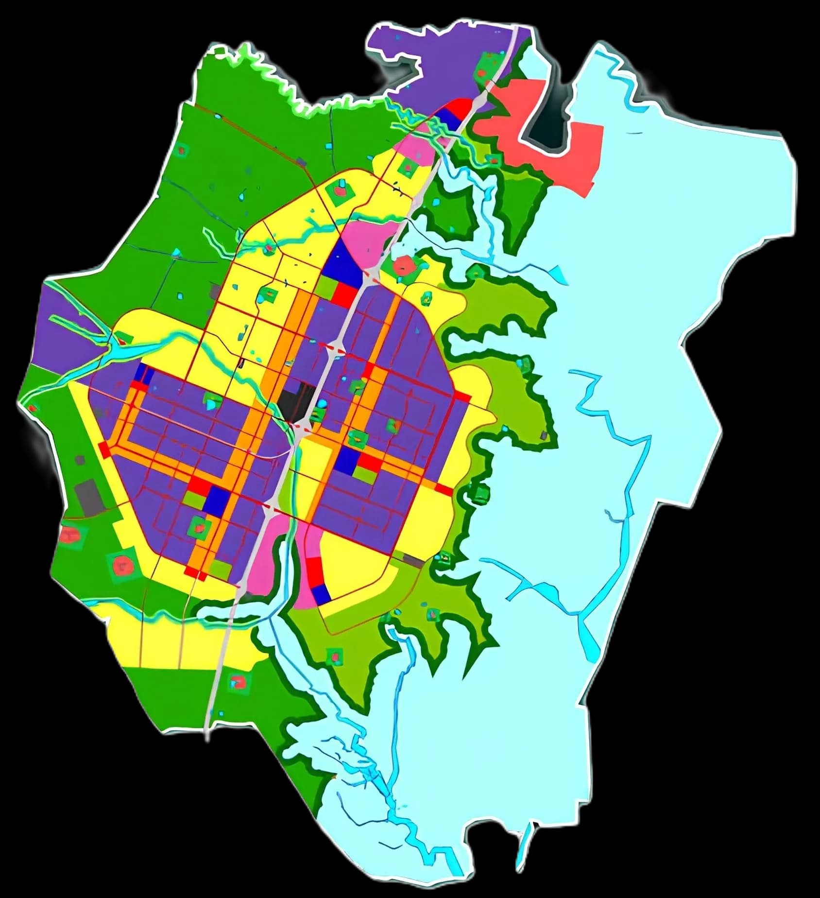
Region
Dholera SIR
Villages
22 Revenue Villages
About Dholera SIR
Dholera Special Investment Region (Dholera SIR) is a large-scale, planned industrial and urban development region in Gujarat, being developed as a greenfield industrial city with integrated infrastructure for manufacturing, business, residential development, logistics and supporting services.
Dholera SIR forms an important part of the Delhi–Mumbai Industrial Corridor (DMIC) and is planned around modern infrastructure, multimodal connectivity, industrial development and sustainable urban planning.
In simple words, Dholera SIR is being planned as a new-generation industrial city where industry, infrastructure, business, housing and urban amenities are developed together through a planned framework.
22
Revenue Villages
~879.34
Sq. Km. Original Notification
~920
Sq. Km. Broader Development Figure
DMIC
Industrial Corridor
Important Distinction
Dholera SIR
Large notified regional development area
The SIR is a large government-notified region comprising 22 revenue villages and planned for integrated industrial, urban, infrastructure and economic development.
Dholera Village
One of the 22 villages
Dholera village is one individual revenue village within the wider Dholera SIR boundary. It is not synonymous with the entire SIR.
The development framework combines industrial planning, infrastructure, town planning, connectivity and future urban services within one integrated regional vision.
Dholera is being developed as a greenfield city, allowing infrastructure and land-use planning to be designed from the beginning rather than retrofitting an old urban area.
Dholera is one of the major industrial nodes associated with the Delhi–Mumbai Industrial Corridor, connecting the region to a larger national industrial and logistics network.
The development framework includes planned roads, utilities, industrial areas, residential areas, commercial areas, public facilities, green spaces and other urban infrastructure.
A central objective of Dholera SIR is to create an environment suitable for large-scale manufacturing and other industrial activities, supported by modern infrastructure.
The region is organized through Town Planning Schemes rather than unplanned development, with different areas planned for different combinations of uses.
Dholera is located in Gujarat and is planned as an important industrial and logistics destination with connectivity to major regional and national infrastructure.
The planning concept brings together industry, residential communities, commercial areas, logistics, public facilities, green areas, recreation and transportation infrastructure.
The planning concept brings together multiple components to create an integrated environment for working, living, learning and recreation.
Industrial Development
Residential Communities
Commercial Areas
Logistics
Knowledge & IT
Public Facilities
Green Areas
Sports & Recreation
Renewable Energy
Transportation
The notified Dholera SIR region consists of 22 revenue villages. The 2009 notification identified 19 villages that were then in Dhandhuka Taluka and 3 in Barwala Taluka.
Area
—
TP Scheme
TP-1
One of the notified villages within Dholera SIR. It forms part of the northern side of the planned SIR area and is associated with Town Planning Scheme TP-1.
Area
111.27 sq. km.
TP Scheme
TP-5 & TP-6
One of the larger villages within the notified SIR area. It is associated with later-stage planning areas, particularly TP-5 and TP-6.
Area
—
TP Scheme
TP-1 & TP-2
An important revenue village associated with TP-1 and TP-2 within the planned town-planning network.
Area
83.08 sq. km.
TP Scheme
TP-4 & TP-6
A large notified village associated with TP-4 and TP-6, forming part of the eastern and later planning areas.
Area
7.40 sq. km.
TP Scheme
TP-2
The smallest of the 22 notified villages by area. It is associated with TP-2 and is located close to the core development area.
Area
16.24 sq. km.
TP Scheme
TP-3
A smaller notified village associated with TP-3 and forming part of the planned expansion area of the SIR.
Area
45.81 sq. km.
TP Scheme
TP-2, TP-3 & TP-4
The village from which the larger Dholera region takes its name. Parts of Dholera village fall within the Activation Area.
Area
55.44 sq. km.
TP Scheme
TP-1
A notified village associated primarily with TP-1 and the planned development framework in the northern portion of the SIR.
Area
31.18 sq. km.
TP Scheme
TP-2
A notified village associated with TP-2 and the central planning framework around the Dholera development area.
Area
72.66 sq. km.
TP Scheme
TP-4, TP-5 & TP-6
A relatively large village associated with multiple town-planning areas and the wider future development framework.
Area
27.35 sq. km.
TP Scheme
TP-1 & TP-2
Its association with two town-planning schemes places it within the broader planned urban and infrastructure network.
Area
38.30 sq. km.
TP Scheme
TP-2
A village forming part of the central Dholera planning framework. Parcel-level verification is necessary when determining specific land classifications.
Area
22.54 sq. km.
TP Scheme
TP-4
A notified village associated with TP-4 and the broader planned development area of Dholera SIR.
Area
33.08 sq. km.
TP Scheme
TP-6
A village associated with TP-6 and the later town-planning framework of Dholera SIR.
Area
17.81 sq. km.
TP Scheme
TP-2, TP-3 & TP-4
Associated with three town-planning schemes. Parts of Mundi are connected with the Activation Area framework.
Area
18.10 sq. km.
TP Scheme
TP-2 & TP-3
A village within the central-to-expansion planning framework of Dholera SIR.
Area
13.96 sq. km.
TP Scheme
TP-3, TP-4 & TP-5
One of the smaller notified villages, associated with multiple stages of the wider town-planning framework.
Area
63.45 sq. km.
TP Scheme
TP-2
One of the larger notified villages, forming part of the broader central planning framework.
Area
18.64 sq. km.
TP Scheme
TP-2, TP-3 & TP-4
Associated with several town-planning areas and connected to the broader planned development framework.
Area
35.49 sq. km.
TP Scheme
TP-3 & TP-5
A notified village forming part of the planned expansion and development framework of the SIR.
Area
40.50 sq. km.
TP Scheme
TP-3 & TP-5
Associated with the wider TP-3 and TP-5 planning framework and the long-term planned development area.
Area
22.09 sq. km.
TP Scheme
TP-4 & TP-6
Associated with TP-4 and TP-6, placing it within the eastern and later-stage planning framework.
The region is organized through Town Planning Schemes rather than unplanned development. Different parts of the SIR are planned for different combinations of industrial, residential, commercial, institutional, logistics, green and recreational uses.
Town Planning Schemes provide a structured framework for organizing land and infrastructure as the region develops.
Planning Framework
Activation Area
The Activation Area is a first-phase development area associated with TP-2A and TP-4A. It should not be treated as synonymous with the entire Dholera SIR.
Parcel-level verification is important when evaluating a specific property, its planning status, land use, zoning, approvals or location within a particular planning area.
The 22-village list corresponds to the notified SIR boundary. Planning schemes, land-use classifications, development permissions, zoning regulations and property status can vary by location and parcel. Buyers and investors should verify property-related information through the relevant government authorities and official documentation before making a decision.
Explore Dholera SIR, understand its planning framework, and discover real-estate opportunities across the region.
Get In Touch
Share your details and we'll get back to you with expert guidance.